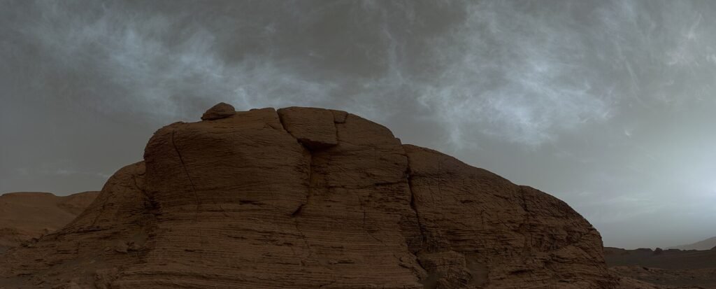
semeion.photo Credit: NASA/JPL-Caltech/MSSS/Simeon Schmauß · CC BY 2.0 · Wikimedia Commons · Source · License
NASA’s Curiosity rover has successfully completed a bedrock drilling campaign at the ‘Nazca’ site near Mount Sharp, collecting samples that feature unusual plate-like and potato-chip-shaped crystals. This investigation provides critical empirical data, allowing researchers to precisely analyze Mars’ past aqueous environments and climate evolution through the morphological characteristics of minerals found within the rock.
Completion of Nazca Drilling and Sample Delivery to SAM
According to NASA’s Mars Science Laboratory team, as of November 11, 2026 (based on mission sol 5063-5069 planning), the Curiosity rover finished pulverizing bedrock and collecting samples at the Nazca drill hole in the lower region of Mount Sharp. The bedrock surrounding the Nazca site is geologically unique, containing a high density of disc-shaped or potato-chip-like thin crystal structures.
The science team successfully transferred the powdered sample obtained from the drilling operation to the Sample Analysis at Mars (SAM) instrument, a sophisticated chemical analysis suite inside the rover. While SAM heats and analyzes the composition and volatiles of the rock sample, ground control has initiated additional exploration plans, utilizing the rover’s other instruments to conduct multi-faceted precision measurements of the surrounding geological and atmospheric environment.
Precision Mineral Investigation via ChemCam and Remote Imaging
In parallel with SAM’s analysis, Curiosity used its ChemCam Laser-Induced Breakdown Spectrometer (LIBS) to precisely target and observe the chemical composition of individual targets with crystalline structures. After performing spectroscopic analysis on the ‘Ahi Veremos’ target, the team moved on to depth-profile LIBS measurements of the ‘Colca’ target and finished with an analysis of the ‘Bermejo’ target.
Additionally, the Mastcam camera system captured high-resolution panoramic mosaics encompassing both the near and mid-ground of the Nazca drill site. The Remote Micro-Imager (RMI) was also used to capture a long-distance mosaic of rock clusters located beneath the ‘Cordillera’ ridge.
MAHLI Nighttime UV Imaging and Phobos Transit Observation
On Sol 5067 (November 7, 2026), the Mars Hand Lens Imager (MAHLI), mounted on the rover’s robotic arm turret, conducted a mosaic of the rock block containing the Nazca drill hole. The team utilized nighttime imaging techniques, activating the MAHLI’s built-in white light and ultraviolet (UV) LEDs to precisely capture fluorescence reactions and micro-textures on the rock surface and within the crystal structures.
During the campaign, the ground team prioritized observing a transit of Phobos, one of Mars’ moons, as it crossed the face of the sun. The rover also conducted environmental monitoring, including searches for large dust devils and recording video of atmospheric motion toward the horizon and zenith, to obtain data on Martian surface weather dynamics.
Exploring Mishe Mokwa Ridge and Continuing South
In the final stages of the campaign, researchers used the RMI to perform detailed observations of exposed bedrock beneath the flat surface of the ‘Mishe Mokwa’ ridge. ChemCam LIBS observations were also expanded to include multiple targets, including erosion-resistant layers on the sides of the Nazca block and clusters of dark float rocks.
Having completed all scientific exploration and driving preparations at the Nazca site, Curiosity began its departure from the area immediately after the observations. The rover will soon rejoin its primary exploration path leading south along Mount Sharp, continuing its long-term journey to uncover the geological evolution of Mars.
Key Data from the Nazca Drilling Campaign
- Mission and Location: NASA Curiosity Rover (Mars Science Laboratory), Nazca drill site at the base of Mount Sharp, Mars
- Observation Sols: Sol 5063 to 5069 (Earth dates: November 6–11, 2026)
- Key Scientific Instruments: Sample Analysis at Mars (SAM), ChemCam (LIBS/RMI), Mastcam, Mars Hand Lens Imager (MAHLI)
- Unique Geological Features: Plate-like and chip-shaped crystal structures within bedrock
- Future Trajectory: Continuing south along the Mount Sharp traverse after departing Nazca
Official Source Information
This article is based on the mission report officially released by the NASA Mars Science Laboratory team on November 11, 2026 (Earth local time).
- NASA Curiosity Blog: Curiosity Blog, Sols 5063-5069 Rocks and Chips (Published Nov 11, 2026)